
Tom Bean, TX
 536 Acres
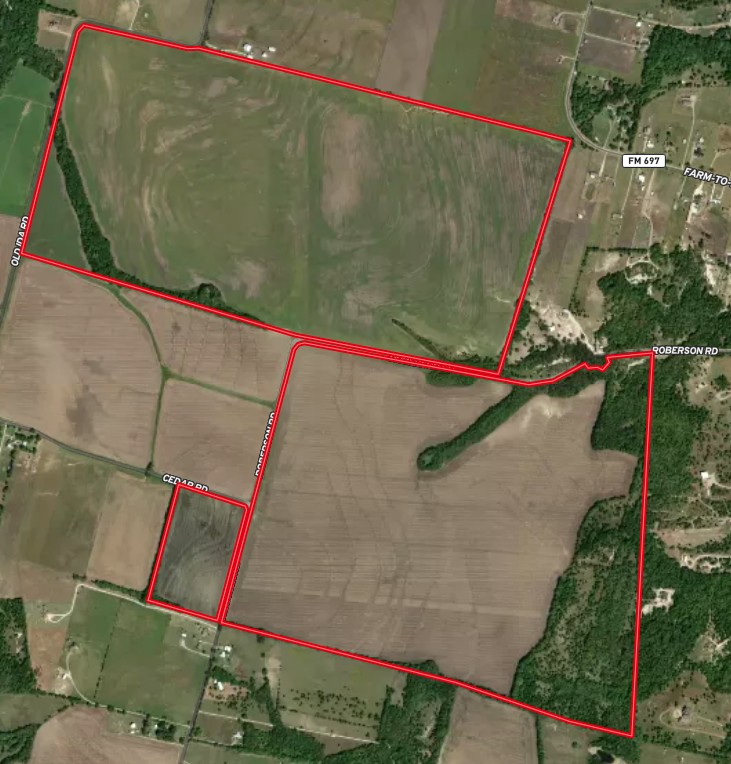
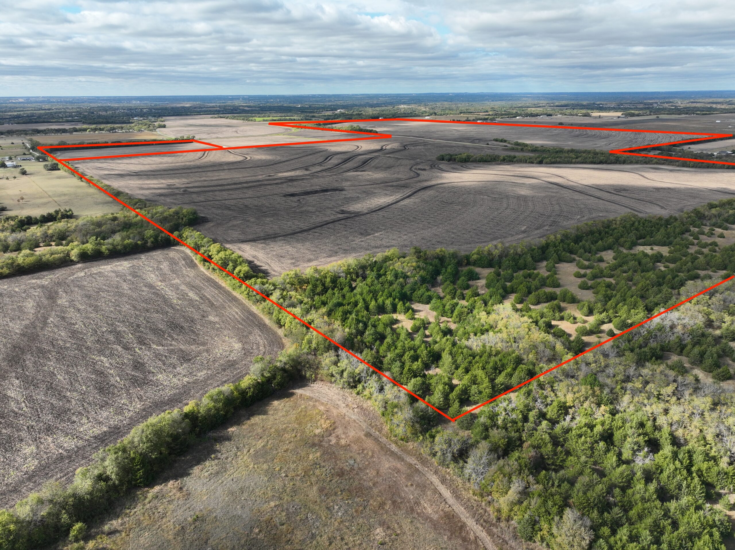
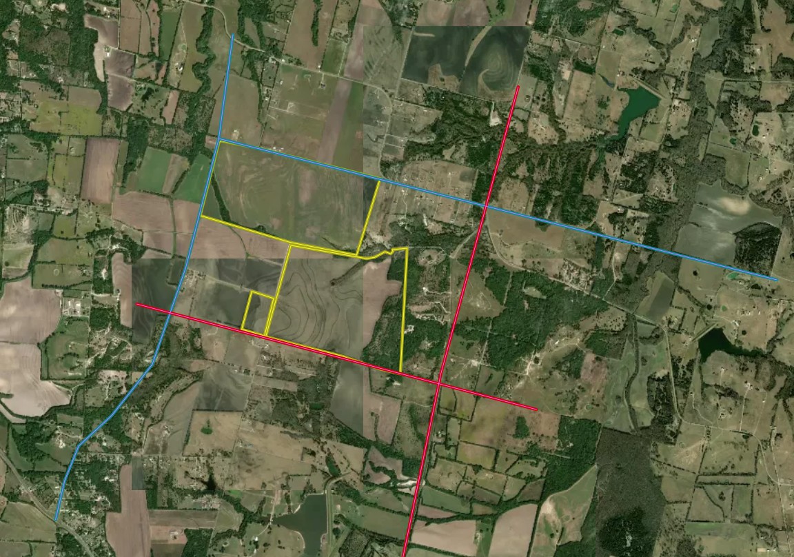
This tract represents a significant contiguous land holding located just outside the city limits of Tom Bean, TX. Four combined parcels form a massive 535.872-acre tract, primarily characterized by agricultural use and long-term development potential.
Location and Access
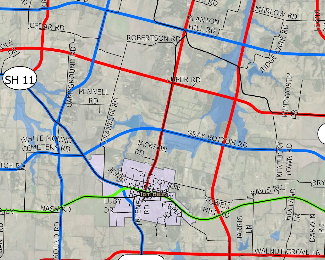
The land is located north/northwest of the Tom Bean city center and has frontage along several roads.
Topography and Land Use
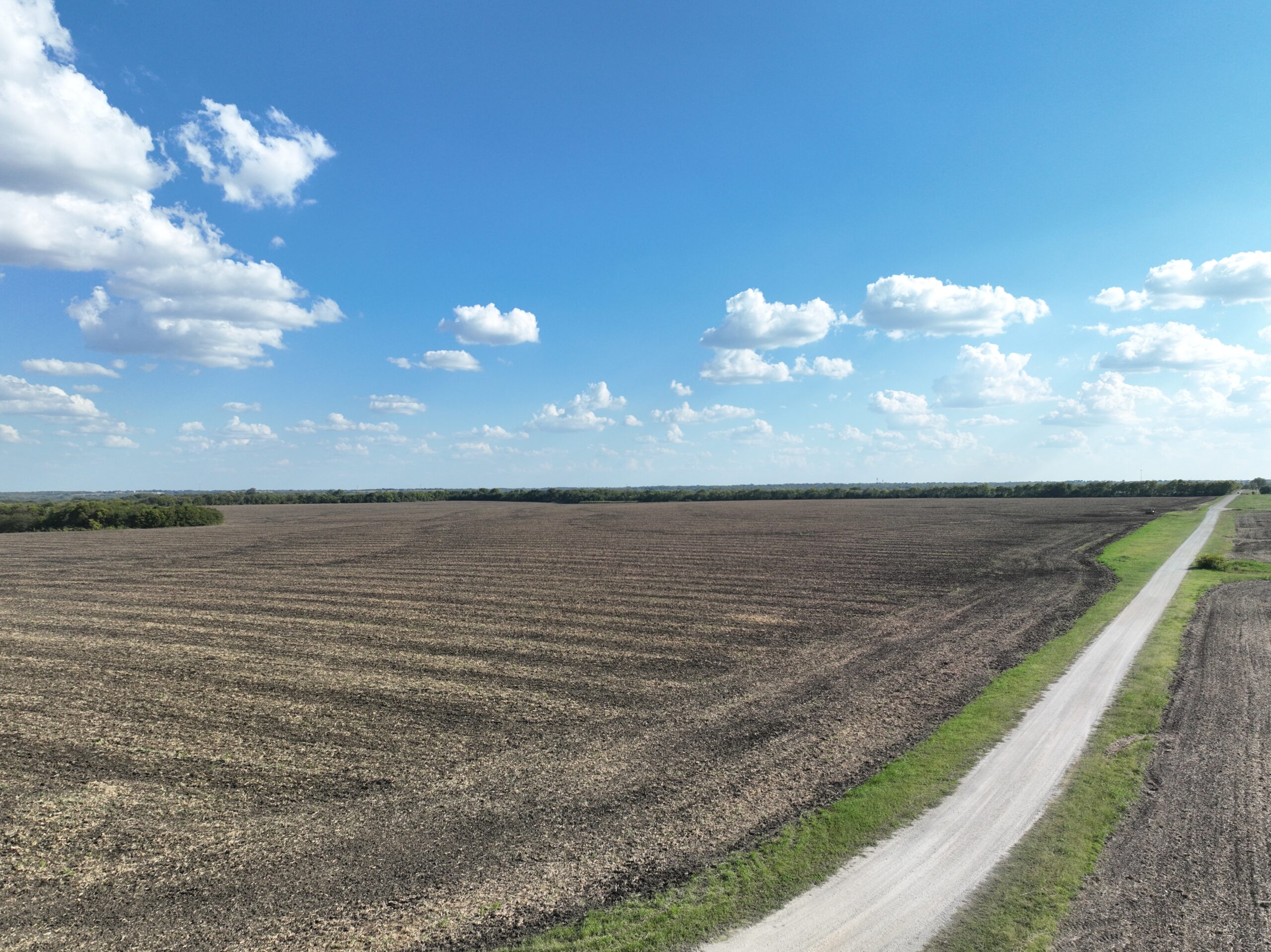
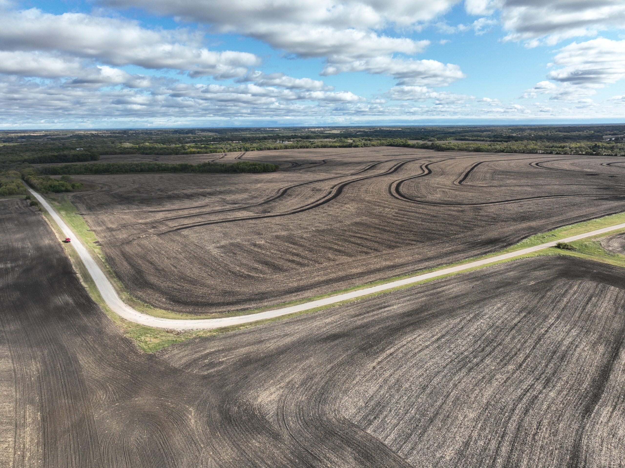
The area is characterized by the rolling “Blackland Prairie” terrain typical of Grayson County.
A mix of open cultivated farmland (wheat/corn/cotton rotation) and improved pasture land for cattle. There are scattered clusters of hardwoods, particularly along the property lines and water features.
Strategic Importance
This specific 535-acre block is notable due to its size. In North Texas, large contiguous tracts are becoming increasingly rare as the Highway 75 and SH 121 corridors continue to push northward from McKinney and Anna.
- Tax Status: These parcels are currently under 1-d-1 (Agricultural) Valuation. This significantly reduces the annual property tax burden as long as the land is used for farming or ranching.
- Development Potential: Given the acreage, this is a prime candidate for a master-planned residential community or a “buy and hold” investment for long-term capital appreciation.
-
LOCATION
From downtown Tom Bean, head north on FM 2729 and take a left on Robertson Road.
Alternatively, from downtown Tom Bean, take Highway 11 towards Sherman and take a right on Franklin Road.
-
COUNTY
Grayson
-
ZONING
Currently under Agricultural exemption.
-
SCHOOLS
Tom Bean ISD
-
FRONTAGE
Currently, frontage on Old Ida Road, Cedar Road, Robertson Road, Franklin Road
According to Grayson County Thoroughfare Plan 2024, it will have frontage along
Whitemound Road – Major Arterial
Akers Road or Rutledge Road – Major Arterial
Luper Road or Milo Road – Minor Arterial -
Topography
Mostly leveled farmland. A few tree areas.
-
UTILITIES
Water: Kentucky Town WSC
Electric: Grayson-Collin Electric Co-op (GCEC)
Sewer: No municipal sewer currently reaches this far; any immediate residential use would require private septic systems unless a MUD (Municipal Utility District) is formed.
The map data provided is for reference only. Boundaries and locations are approximate and may not be fully accurate. Information furnished is from sources deemed to be reliable, but is not in any way guaranteed by us and is subject to change in price, corrections, errors and omissions, prior sales or withdrawal without notice.